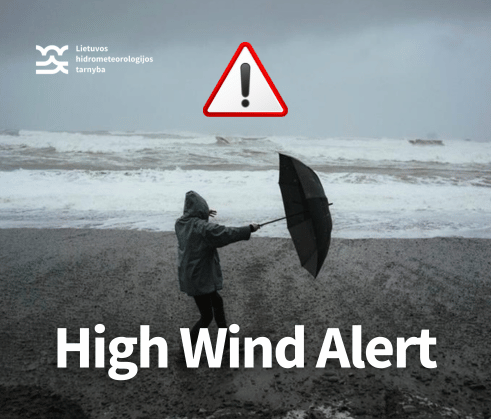
On the night from Sunday to Monday (10 PM–2 AM), southwesterly and westerly winds are expected to strengthen significantly. During the second half of the night and early Monday morning, wind gusts will reach 18–23 m/s across much of the country, 24–29 m/s in the southwestern regions, and up to 30–32 m/s along the coast. Winds are expected to begin easing in the afternoon.
Be cautious: secure or remove loose objects, close windows and doors, avoid parking near trees, and exercise care while driving or walking outdoors.
Author: Eligijus Labanauskas
14 October 2024 | Lithuanian Hydrometeorological Service delegation visits Norwegian Meteorological Institute
A delegation from the Lithuanian Hydrometeorological Service visited the Norwegian Meteorological Institute (MET Norway) as part of a project under the Nordic-Baltic Mobility Program for Public Administration. The visit aimed to strengthen international cooperation and facilitate the exchange of best practices between the two organisations.
During the visit, the delegation explored several key topics. One of the main areas of focus was the development of impact-based weather forecasting, aimed at improving the accuracy of warnings and raising public awareness of potential hazardous weather events.
Discussions also covered the potential for partnerships with other institutions to expand the meteorological observation network and ensure data quality, with particular attention given to integrating stations from third countries.
Another significant topic of discussion was the application of artificial intelligence and machine learning in meteorology. The delegation examined how these technologies could enhance the precision of hazardous weather predictions and improve data processing efficiency.

11 October 2024 | Australian Bureau of Meteorology Representative Visits the Lithuanian Hydrometeorological Service (LHMT)
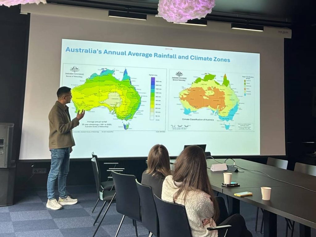
On October 10, the Lithuanian Hydrometeorological Service (LHMT) hosted a meeting with Jonathan How, Senior Meteorologist from the Bureau of Meteorology, Australia. During his visit, Jonathan shared valuable insights on Australia’s climate zones, the distribution of annual rainfall, and public communication strategies that help deliver meteorological information effectively to the public and decision-makers.
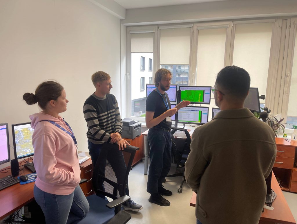
LHMT specialists also gave presentations, covering important topics such as forecasting, meteorological observations, and information dissemination. The discussions focused on the latest practices, challenges, and ways to improve the delivery of meteorological data to the public, ensuring more accurate forecasts.

7 October 2024 | ICEREG Project Report
Project Overview
The management of ice jam flood risk in the Latvian and Lithuanian regions in the context of climate change (hereinafter referred to as ICEREG) is a cross-border project aimed at improving the management of ice jam flood risk in the border regions of Lithuania and Latvia. The main objective of the project is to develop comprehensive flood risk maps and improve the conceptual model of ice jam formation, taking into account the impact of climate change.
Ice jams pose a significant threat as they can cause large-scale flooding and inflict considerable damage on the environment and economy, particularly in border communities. Since the dynamics of ice jams have not been thoroughly studied to date, the ICEREG project seeks to analyze this phenomenon in greater detail, with special attention to the meteorological and hydrological conditions that lead to flood formation.
Research Overview and Results
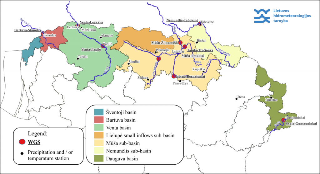
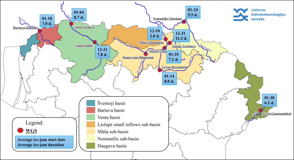
The project analyzed ice jam occurrences in rivers across northern Lithuania, focusing on 10 water measurement stations (WMS) located on the Bartuva, Venta, Mūša, Nemunėlis, Lėvuo, Tatula, Daugyvenė, and Svyla rivers. The analyzed period spanned from 1961 to 2023. During this time, a total of 237 ice jam events were recorded, with the highest number of events (50) at the Trečionys WMS and the lowest (1) at Žilpamūčiai WMS.
Impact and Damage of Ice Jams
Ice jams are particularly dangerous due to their unpredictability and the rapid rise in water levels they can cause. They form when larger ice floes get stuck on obstacles in the river, creating a temporary dam, which can quickly lead to natural disasters. Water levels rise above the jam and drop below, posing a significant threat to residents, infrastructure, and the environment.
Key Events
In the early 21st century, significant ice jam floods occurred in the Mūša and Lėvuo rivers. In 2010 and 2013, water levels in the Mūša River near Ustukiai exceeded critical levels by 90 cm and 125 cm, respectively. The April 2013 floods caused considerable damage in the Pasvalys district, where homes, gardens, and warehouses were flooded.
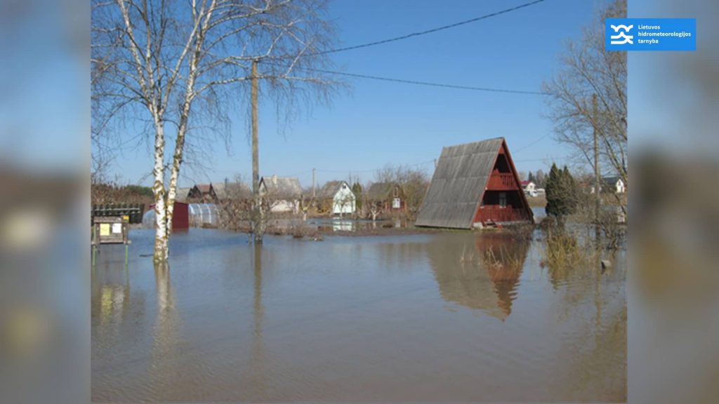
Similarly, in the Lėvuo River, significant water level increases due to ice jams occurred in 2010 and 2018, posing risks to nearby areas.
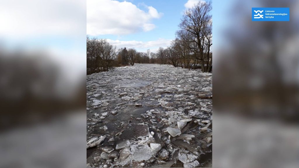
Conditions for Ice Jam Formation
Ice jams typically form when there is a sudden thaw after ice cover has developed in rivers, especially with significant temperature fluctuations between day and night. On average, ice jams start on January 10th at the observed WMS, and the ice jam period lasts about 8 days. The earliest recorded ice jam start date was October 30th (Tatula – Trečionys WMS, 1979), and the latest was April 14th (Mūša – Ustukiai WMS, 2013).
Pilot River Sections for Modeling
Two pilot river sections were selected for the project – Lėvuo (from Pamarliškiai to Skaistgiriai) and Mūša (from Gustoniai to Ustukiai). These sections were chosen due to their long observation periods and the significant impact ice jams are likely to have on the environment and residents. Based on historical data analysis, a conceptual model of ice jam formation and flooding is being developed, which will help assess changes in the primary parameters of ice jams based on climate change scenarios.
Conclusions and Next Steps
The ICEREG project is an important step towards improving the management of ice jam flood risks. The development of flood maps and the conceptual model will not only enhance the resilience of regions to flooding but also help create more effective early warning systems. The results of the project will be used not only for scientific purposes but also for practical flood prevention measures.
In the next phase of the project, detailed climate change scenario assessments will be conducted to better understand future ice jam dynamics and ensure that regions are prepared to face the challenges posed by a changing climate.
2024-07-15 | One of the most powerful tornadoes in the history of the country was recorded in Lithuania on 13 July
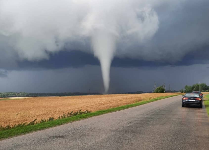
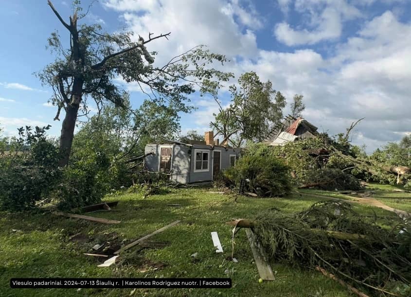
According to LHMS data and residents’ reports, fierce tornadoes were raging in Lithuania in the afternoon of 13 July. Although it is doubtful whether it was two different tornadoes or one that weakened, picked up and came down again, reports indicate that at around 16:00 the disaster struck the village of Jauniškės in the district of Kelme. Several farmhouses were badly damaged, with roofs blown off, trees and electricity pylons uprooted.
Translated with DeepL.com (free version) 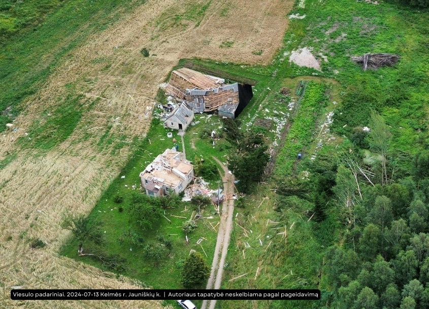
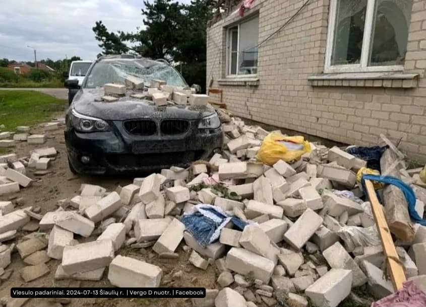
The second tornado appeared around 17:00 in the villages of Vileikiai, Pakapė, Meškiškės and Einoraičiai in Šiauliai District. Here the damage was similar, but over a larger area: roofs of houses were destroyed, outbuildings were damaged, a car was smashed and electricity was cut off. According to the available data, there were no significant injuries to health.
Wind measurements at the centre of the storm were not taken due to the destructive power of the vortices. In many countries, the strength of tornadoes is rated on Ted Fujita’s F scale, from F0 to F5.In terms of damage, the latter tornado could be classified as F2, with wind speeds in the middle of the eddies of 60-70 m/s.
The LHMS has officially registered 40 tornadoes.The most powerful one so far (tractor lifted, trucks uprooted, person killed) was recorded on 29 May 1981 in Širvintos. It is believed to have been an F2 class.
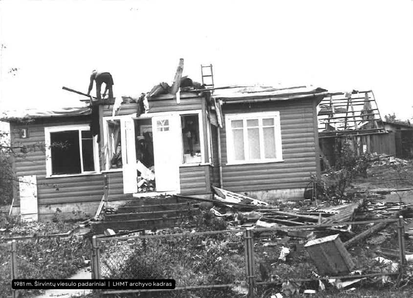

This 2024 tornado is equivalent to the 1981 Širvintos tornado and the 2011 Ginkūnai, Šiauliai suburban tornado.All three tornadoes are classified as F2 and had wind speeds of up to 70 m/s. Historical photographs show that the damage in Širvintos was quite similar to the current damage, with stone walls remaining standing, so there is no evidence that this tornado was stronger than an F2 rating. The last tornadoes in 2022, 2023 were observed over the Baltic Sea.
Although nature has shown its power this time, the communion of Lithuanian citizens is of paramount importance now. Neighbours need to help each other, share resources and other assets.Municipalities must be actively involved and provide assistance to those affected.Only by working together can we overcome the effects of this disaster and rebuild what has been lost.
In the face of this disaster, we see once again that strength lies in unity and the ability to help each other. Let us stand together and support each other in this time of trial.
